
// HYDROLOGICAL · AGRARIAN · CULTURAL TELEMETRY
ANEGBETE SYSTEM READOUT
Direct riverine orientation toward the Niger basin.
Agriculture remains central to the local economy.
Community fishing-guild representation.
Waterways remain a defining element of the riverine identity.
// ANEGBETE DIGITAL ARCHIVE
COMMUNITY INFORMATION TERMINAL
A single electronic information interface bringing together geography, population context, weather, environment, commerce, agriculture, transportation, culture, heritage, and community identity.
Edo State, Nigeria.
A landscape shaped by water, farming, fishing, movement and trade.
6.6244° E
FISHING
TRADE
Population figures should be read from the latest authoritative census or demographic source rather than an invented local estimate.
SEASONAL
This archive intentionally does not fabricate a live temperature or rainfall reading. A live weather API can be connected here later.
// ATMOSPHERIC PROFILE
WEATHER & RIVERINE CLIMATE
Anegbete's environment is inseparable from its agricultural and riverine identity. Seasonal rain, intense tropical sunlight, soil moisture and changing river conditions influence farming, fishing and movement.
CLIMATE MODE
Seasonal tropical conditions with distinct wet and dry periods.
PRESENTATION NOTE
The climate panel describes the environmental profile rather than inventing a current weather observation. When a live weather service is connected, this same interface can display current temperature, rainfall probability, humidity, wind and forecast data.
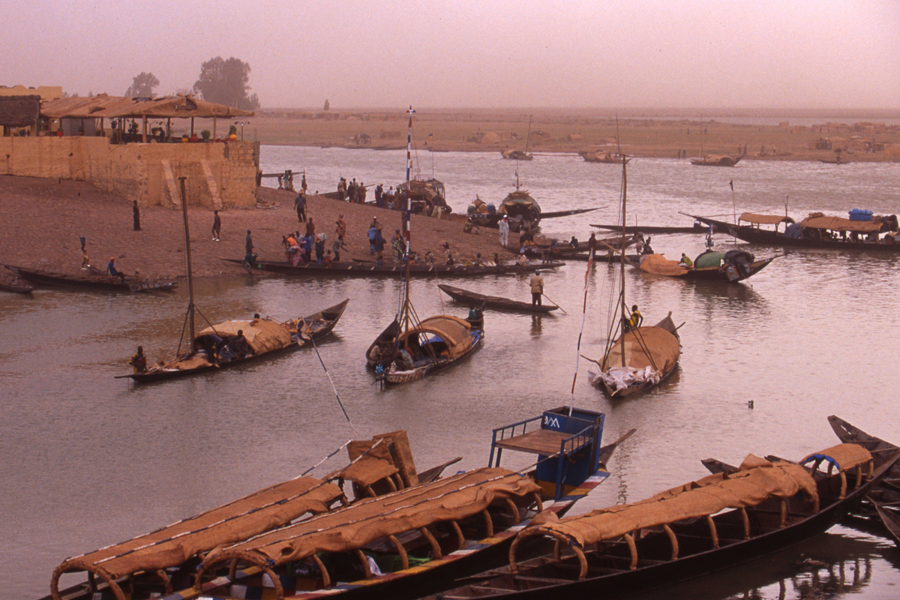
01 / WATERWAY COMMERCE
RIVER NIGER DOCKS & ROUTE
Water is not simply scenery in Anegbete. It is infrastructure, livelihood and movement. Canoes, fishing craft and river transport form part of a landscape where commerce and community life meet.
The riverine environment creates a natural connection between agricultural production, fishing activity and wider regional exchange.
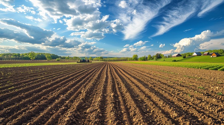
02 / AGRARIAN POWER
ALLUVIAL SOIL & FARMING
Farming remains one of the central pillars of the community economy. Yam, cassava, grains and other crops connect households to both subsistence and regional commerce.
The relationship between water, soil, seasonal rainfall and human labour gives the landscape its agricultural character.
// COMMUNITY ARCHITECTURE
THE ANEGBETE SYSTEM
A living network where people, land, water, agriculture, transportation and cultural memory operate together.
PEOPLE
- Identity Riverine Community
- Social Core Families / Clans
- Labour Farm / River / Trade
- Mobility Road + Water
ECONOMY
- Agriculture Yam / Cassava / Grain
- Fishing Freshwater Catch
- Commerce Produce / Goods
- Transport Canoe / Road
ENVIRONMENT
- Water Niger Basin
- Climate Tropical Seasonal
- Terrain Riverine / Agrarian
- Resource Water + Soil
03 / TRADITIONAL HERITAGE
RIVERINE MASQUERADES & ANCESTRAL FESTIVALS
Cultural performance creates another layer of the community system. Masquerades, traditional gatherings, age-grade activity and ancestral memory connect the present generation with those who came before.
// RIVER · EARTH · PEOPLE
ANEGBETE
A riverine world defined by movement, agricultural strength, fishing knowledge, community labour and cultural continuity.